About Us
Indicators are becoming increasingly important tools for communicating information to decision makers and the public, as well as in assessing the environmental performance and evaluating the progress made by actions applied to combat land degradation. In environmental sciences, a single indicator cannot efficiently describe a complex process such as soil erosion or land desertification. Indicators combined in a composite index allow someone making multiple choices in land management and hence in monitoring of the state of the environment.
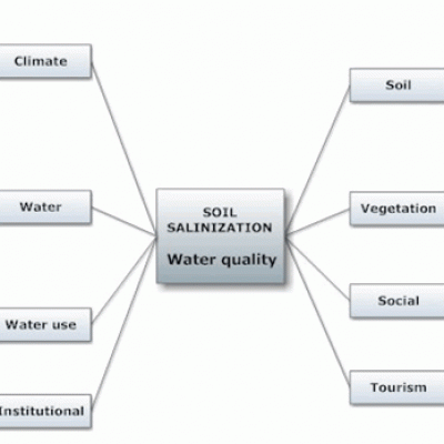
The fundamental process or causes of land degradation and desertification are degradation of vegetative cover, water erosion, soil salinization, overgrazing, forest fires, water deficient, etc. All these degradation processes are caused almost by the same mechanisms or driving interrelated forces.
The European Environmental Agency has considered that an indicator is a measure, generally quantitative, that can be used to illustrate and communicate complex phenomena simply, including trends and progress over time (EEA, 2005). Based on the research conducted by the EU MEDALUS II project, Environmentally Sensitive Areas (ESAs) to desertification exhibit different sensitivity to desertification for various reasons. Four general types of ESAs have been distinguished based on the stage of land degradation (Kosmas et al., 1999):
- Critical ESAs: Areas already highly degraded through past misuse, presenting a threat to the environment of the surrounding areas, i.e. badly eroded areas subject to high run-off and sediment loss. This may cause appreciable flooding downstream and reservoir sedimentation.
- Fragile ESAs: Areas in which any change in the delicate balance between natural and human activity is likely to bring about desertification. For example, a land use change (a shift towards cereals cultivation) on sensitive soils might produce immediate increase in run-off and erosion, and perhaps pesticide and fertilizer pollution downstream.
- Potential ESAs: Areas threatened by desertification under significant climate change, if a particular combination of land use is implemented or where offsite impacts will produce severe problems elsewhere, for example pesticide transfer to downslope or downstream areas under variable land use or socio-economic conditions.
- Non-Threatened ESAs: Areas with deep to very deep soils, nearly flat, well drained, coarse-textured or finer textured soils, under semi-arid or wetter climatic conditions, independently of vegetation, are considered as being non-threatened by desertification.
The various types of ESAs to desertification are distinguished and mapped by using certain key indicators or parameters for assessing the land capability to withstand further degradation, or the land suitability for supporting specific types of land use. A simple methodology has been developed by Kosmas et al. (1999) to identify ESAs to desertification by using 15 simple indicators related to soil, climate, vegetation, and land management characteristics.
The developed methodology on ESAs to desertification describe the stage of land degradation under certain physical environmental characteristics and land management practices. Based on the specific stage of land desertification, another methodology has been developed by the DESIRE project to assess the risk of land degradation and desertification and to identify land management practices for combating desertification. In this project the following five classes of desertification risk have been defined:
Very high desertification risk. Critical areas to desertification very highly degraded subjected to very high erosion rates due to intensive cultivation, overgrazing, frequent fires; or to very high salinization rates due to the presence of shallow groundwater table or irrigation with poor quality of water.
High desertification risk. Critical areas to desertification highly degraded subjected to moderate or slight erosion rates or fragile areas to desertification moderately degraded subjected to very high erosion rates due to intensive cultivation, overgrazing, frequent fires; or to high salinization rates due to the presence of moderately shallow groundwater table or irrigation with poor quality of water.
Moderate desertification risk. Fragile areas to desertification moderately degraded subjected to high or moderate erosion rates or potential areas to desertification subjected to very high or high erosion rates due to intensive cultivation, overgrazing, frequent fires; or to moderate salinization rates due to the presence of moderately deep groundwater table or irrigation with moderate quality of water.
Low desertification risk. Fragile areas to desertification moderately degraded subjected to low erosion rates or potential areas to desertification slightly degraded subjected to moderate erosion rates due to intensive cultivation, overgrazing, frequent fires; or to low salinization rates due to the presence of relatively deep groundwater table or irrigation with moderately good quality of water.
No desertification risk. Potential or non-threatened areas to desertification slightly or no degraded subjected to very low or no erosion; or fragile, potential, non-threatened areas to desertification subjected to no salinization risk due to the presence of very deep ground water table or irrigation with good quality of water.


